Showing posts with label Denver. Show all posts

Monday, January 31, 2011

Storm Update

Unfortunately it looks like the low is going to track too far to the south to give us the best shot at impressive snow totals. That said, the snow, cold, and wind have settled in and will not be going anywhere in a hurry. Especially the frigid temperatures. While we will likely see light snow continue off and on into Tuesday, it is the sub-zero temperatures that we will really need to watch.
Low tonight: -5 (wind chill -20 to -30)
Tuesday Hi: 0
Tuesday Lo: -19 (wind chill -30)
Wednesday Hi: 9
Wednesday Lo: -4

These images are from the Weather Channel and the NWS respectively. The first showing the current weather with the low tracking south of Colorado, and the second showing the latest snowfall predictions for the region.

For more on the storm and record cold, please see yesterday's post. Stayed tuned for updates on the storm, and edits to the going snowfall forecast if necessary!

Sunday, January 2, 2011

Happy New Year!

The frigid arctic air mass that has gripped the region since Thursday is finally pulling away. While we will not be returning to the mild 50s and 60s we had grown so accustomed to over the last months, sunshine and 40 should feel quite nice. Overall this week should be quite pleasant, with just a few backdoor fronts keeping our temperatures down a bit. Pick day of the week? Thursday, when highs could approach 50 degrees.

By Thursday night and Friday we start to see some model disagreement. The GEM shows a decent disturbance slicing across northeast Colorado which would give us much colder temperatures and a chance for snow, while the GFS and ECMWF keep this front more open and further north. For now will hedge towards the warmer/drier forecast, and wait to see if we can get some agreement over the next several days.

Monday, December 27, 2010

Best chance yet!

For several days now meteorologists at the National Weather Service have been tracking what appears to be our best chance of widespread snow across the front range so far this season. I have held off on writing anything about it because of my personal skepticism that this will actually come to fruition, and the uncertainty that remains with the eventual track of the low pressure system hanging off the Pacific coast. After three months of virtually no snowfall, it is hard to imagine all the ingredients will actually come together to bring us a real storm.

With the system not due in until sometime Thursday, let us take a look at a couple of possibly scenarios. The first, and best, is shown to the right in this GFS weather model. The low tracks across southern Colorado, giving Denver the best chance for prolonged, moderate snowfall (depicted in blue in the lower image). Some models, however, continue to track the low further north which would greatly impede our chances at getting a good snowfall in Denver. Either way, cold air is due to arrive in a fury, and will likely bring us some of the coldest temperatures of the season. Friday's highs may struggle to get out of the teens.

Sunday, December 19, 2010

The Great Wall

System after system continue to pummel the mountains with snow. There seems to be an invisible wall that prohibits any of that moisture from making it just an hour east into Denver. While many mountain locations (especially west facing slopes) are bracing for upwards of SIX FEET snow by Tuesday, Denverites are starting to wonder if we will ever see snow again. Officially we have only seen about 2 inches of snow this season, with many neighborhoods in town not even seeing that much. While we are already flirting with the driest December on record, pretty soon we may very well be talking about the driest winter on record.

It does not look like we will have a white Christmas this year, breaking a streak of four years in a row. There is a slight chance of snow Monday (only 10%), but otherwise this last week before Christmas looks nothing short of uneventful.

Bottom line is there have been plenty of storms pushing onshore this winter but the storm track just isn't favorable for Denver. Often La Nina means not only a milder winter for Denver, but a delayed onset as well. Let's hope for the latter, and as we head into the new year maybe the mountains will share a little of the white stuff with us.

Current weather from the Weather Channel shows an incredible amount of moisture pouring into California, and will feed heavy snows in the Colorado Mountains over the next several days.

Wednesday, December 15, 2010

Winter Weather Advisory Cancelled

The National Weather Service has cancelled the winter weather advisory they issued for this afternoon and evening. Apparently my skepticism wasn't too far off. Moist air and upslope is still expected, but many locations will only see and inch or two, if that. Higher amounts still expected to be west and south of the city.

Saturday, November 20, 2010

More mountain snow, Denver remains dry

Ski resorts across Colorado's high country are basking in what is shaping up to be one of the best Novembers in recent memory. Many mountain locations picked up two feet of snow last week, and are bracing for more of the white stuff in the coming days. According to the Denver Post, some locations could pick up as much as four feet of snow this week, a scary headline for one of the busiest travel times of the year. The good news (if you want to call it that) is that the densely populated front-range will once again be spared, and travel in and out of DIA should not be interrupted. While forecasters are calling for the coldest temperatures of the season to roll into Denver on Wednesday, at this time it does not look like any snow will be accompanying it (NWS). Temps should rebound nicely going into next weekend, and the wait for Denver's first (real) snow will continue...

This image from the National Weather Service, and edited by yours truly, shows winter storm warnings from California to Colorado, but nothing east of the Divide.

Sunday, November 7, 2010

Summer's Last Hurrah?

Snow may finally fly across the metro area this week. After flirting with record highs across Colorado on Saturday, most locations in the state are in for a big change coming as soon as Monday. Denver should sneak in one more beautiful day to start the week, but will see a chance of snow and cooler temps by Tuesday. Thursday looks to bring the best chance for measurable precip to the area as highs are expected to hold in the 30s with the passage of a stronger cold front. The National Weather Service warns that there is still plenty of uncertainty with this system, and depending on the model we could be too far north for the best snow or on target for things could get interesting around here. With the system still several days out there is plenty of time to work out the details.

One thing is for sure, it won't be 80 degrees any time soon as it looks like we are in for an extended period of unsettled weather. Highs are expected to stay at or below seasonal norms for the period, with lows possibly dipping into this teens this weekend.

Sunday, September 26, 2010

Bone Dry

The calendar says fall, but the weather has been anything but. Already setting several record highs (96 degrees last week), coupled with no rain in nearly four weeks, it is feeling a little more like the end of July than late September. The outlook is no different; warm sunny weather is expected through the period.

The long term forecast does not look much different. According to the National Weather Service there has been an emergence of La Nina in the Southern Pacific, which usually means a warmer and dryer winter than average for Colorado. The three month outlook recently released shows just that. So while it is not at all uncommon to see freezing temperatures and snow in September, it looks like it would be several weeks before we see either. The average first snowfall for Denver is October 19th.

Saturday, August 14, 2010

Severe Drought

That's right, it has been a long long time since I last blogged. A slow summer, slow readership, and summer weather so boring you could cut it with a knife has kept me away from here for awhile.

All that said, the seasons will soon be changing, and with a renewed interest over the last weeks by many of my longtime readers, I thought I would break out the old pen and ink and talk a little weather.

After an extended period of scorching mid-90s, the National Weather Service's extended forecast shows temps peaking in the mid to upper 80s over the next week or so which will be much welcomed by many. Sunday (tomorrow) will be even cooler with highs in the 70s and overnight lows dipping into the 50s. That is not to say we have cleared any threat of extended heat waves (we will likely see upper 90s many more times before winter), but with September just around the corner, it's never too early to start talking snow!

Up next: La Nina makes a return, and early forecasts for the coming winter.

Sunday, May 9, 2010

Springtime in the Rockies

Well folks, hope you enjoyed a beautiful Mother's Day today as our summer sneak-peak appears to be short-lived. Some pretty wild forecasts are getting thrown around for an approaching storm system due in midweek. Many foothill locations (Castle Rock, Genesee, Evergreen) have already been placed under a winter storm watch where upwards of 18 inches of snow is expected. For Denver, the forecast remains very uncertain. We can all hope that temperatures will stay warm enough Tuesday night keep us as all rain, but the potential exists for rain to turn to snow and for the city to see a wet whopping of snow.

There are about seven months a year that I would be SUPER pumped right about now. May is not one of them. In the last week trees have leafed like "woah" --- and the potential for a heavy, wet snow means we should brace for quite some damage. With that, break out the shovels and the brooms... and hope for rain!

Wednesday, April 28, 2010

Snow in May not as cool as snow in December

Unfortunately, weather happens with little regard to how we feel about it. After summer-like conditions today (highs broke 80 degrees in many locations) we are in for a reality check tomorrow. The cold, wet weather - which is not all that uncommon for Denver this time of year - is returning with a punch, dropping highs nearly 30 degrees Thursday from where we were today. Scattered rain and rain/snow mixes are in the forecast nearly every day through the weekend. While lows may drop into the 30s several nights in row, we likely wont be seeing any blizzards here in town... it'll be just cool and wet enough to make things uncomfortable at times.

Not an awesome forecast for all my faithful readers who will likely be attending a moving party Friday and Saturday and then the event-of-the-year Saturday with the Oblio's Arrow CD release at the Larimer Lounge. High Saturday are forecast to be in the low 50s with drizzle. Ugh.

Thursday, April 22, 2010

Flirting with snow?

Springtime in the Rockies can be quite spectacular when it comes to weather, and the next 48 hours are gearing up to be just that. The latest forecast from the National Weather Service shows a barrage of weather advisories issued across the state, including: winter weather warnings, winter weather advisories, winter storm watches, tornado warnings, tornado watching, severe thunderstorm warnings, flood advisories... the list goes on.
At this time any precipitation to fall in Denver looks to be all rain over the next few days. Areas to our south and west (i.e. Castle Rock) may end up with a late-Spring whopper of a snowstorm if temperatures drop enough tomorrow evening. Many mountain locations are bracing for 15 - 30 inches of snow!

Take a look at the current radar and warning map (click to enlarge):


Tuesday, April 6, 2010

Mountain Snow

Another system is bringing another much needed round of snow to the high country. Many mountain locations north of I-70 could be measuring this storm in feet before it is all said and done. For the plains, not so much. Today, however, will be noticeably colder than yesterday, with highs struggling to make it out of the 40s. Some rain and snow showers may drift off the foothills today and tonight - but would not expect anything in terms of accumulation. By later in the week the 60s will return, with 67 degrees predicted for first pitch of the Rockies' Home Opener!

Thursday, March 25, 2010

Another Storm?

We might have to wait a few more days for Spring as yet another storm is waiting in the wings. With many areas logging a whopping 30 inches of snow in the last week alone, this coming storm may only add to that, and in a big way. At this point Denver is not in the winter storm watch that has been posted for most of eastern Colorado, including Castle Rock and the southern foothills... but this may change if some agreement can be made between the models. With the forecast as is, Denver will likely miss out on the brunt of the storm, but if we can get the winds to shift just a little bit, we could be talking about another 8 - 16 inches as is predicted for most of the watch area. Worth keeping an eye on...

Wednesday, March 24, 2010

Snowstorm comes to an end...

But not before dropping quite a bit of snow up and down the the front range. After coming in with a roar last night, with snowfall rates in excess of 2 inches an hour, thunder, and wind... the snow continued lightly through the night. This morning there are just a few lingering snow showers, along with sloppy roads and closed schools and businesses. Even with temperatures below freezing, the snow is melting nearly as fast as it fell. By noon most of the streets will likely be completely melted off. Here are a few photos from this latest storm, I have also posted some of the impressive snow totals on the right.


Tuesday, March 23, 2010

In for a doozy of a storm!

Snow has moved in, and with any luck at all it is here to stay for a few hours. Snowfall forecasts range from 5 to 20 inches depending on who you talk to... it really is just a wait and see. Provided the winds do not shift a little more northerly after midnight, we should be on the upper end of the snowfall forecasts with snow continuing into the day tomorrow. If they do shift, the heavier snow will move into the southern suburbs and Monument hill area - cutting our flow off early.

Already an inch and counting up here... We'll see!

Wednesday, March 17, 2010

Finally a storm worth blogging about?

It has been a long time since we have been under any kind of winter weather advisory, but that could all change in the next 24 hours. Already the National Weather Service has issued a winter storm watch for much of northeast Colorado, including Denver, for a potential storm Thursday night and Friday. At this point best estimates are looking like 5 - 10 inches of snow in most locations. Temperatures should be cold enough with this system that precip should be all snow (unlike last weekend), but ground temperatures have warmed significantly over the last days which always makes spring snowfall forecasts quite difficult. In any event, a good chance of snow and likely very gusty winds are in store for Friday - let's see what happens!

Until then, enjoy another day in the 60s on Thursday.

The following image shows the winter storm highlights for northeast Colorado (NWS).

Friday, January 22, 2010

Giant winter storm continues to pound the west; will miss Denver

An impressive storm that has churned for days over the southwest has started to push north and east. Denver looks like it will dodge the bullet, with only a slight chance of rain and snow showers over the weekend. Our mountains on the other hand, especially in the southwest, will receive a healthy dumping of snow - 2 to 4 feet of the white stuff! Good news as many mountain locations are way below normal for snowfall this year. Portions of southern California and the higher terrain of Arizona saw anywhere from 5 - 7 feet of snow from this system. Hot damn!

Nothing too impressive looming on the horizon for Denver. January tends to be a pretty slow month for weather here in town, and this year is panning out to be no different. Watching a few shortwaves that may bring a chance for precip during the middle of next week... but we will see.

Thursday, January 7, 2010

Bitter Cold Grips Nation

Just how cold did it get overnight? -16 degrees F was the low temperature recorded at Denver International Airport sometime just after 3am this morning. Currently we are not doing much better... hovering at about 8 degrees below zero. We are not alone in this arctic blast as nearly every state in the country is getting a little taste of winter. Check out the current wind chill map from the weather channel - it feels like -44 degrees in parts of North Dakota! Highs are expected to stay in the low teens in Denver today... but with the sun shining, this should be bearable. Tonight's lows will once again drop below zero before we make a nice recovery for the weekend!

Sunday, January 3, 2010

Happy New Year, Snow, and January Outlook

As I mentioned in my previous post, it looks like another potent cold front is going to drop out of Canada and bring some weather changes to much of Colorado including Denver on Wednesday. With still several days to tweak the forecast I will refrain from getting too excited, or specific, and instead will just mention a good chance of cold Canadian air and some snow to effect the area for Wednesday into Thursday.

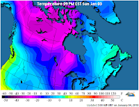
Much of the nation is already under a deep freeze. The first map from the Weather Channel and shows current wind chill values in the U.S., the second is from the Weather Underground and shows the cold Canadian air mass waiting in the wings.
January tends to be a pretty calm month for Denver. The National Weather Service's climatology page states it is Denver's coldest month, and fifth snowiest. The coldest temperature ever recorded in Denver of -29 degrees F occured during the month of January. Wind is often the biggest story of the month, providing us with those warm windy days so common during the early part of last year. Last January also made it in the top five for driest Januaries on record - let us hope 2010 starts a little wetter (and colder) than 2009!