Showing posts with label snow. Show all posts

Sunday, April 3, 2011

Rain, snow, wind, and cold barrel south

As I mentioned yesterday, today's weather is rapidly changing. This morning temps were still a balmy 65 degrees in central Denver. By 10am the skies had darkened and wind had picked up. At this hour the temperature has dropped into the mid 40s.

As one can see by the image to the right, there is a decent amount of precipitation heading towards us from the northwest. Rain and snow showers have already worked their way into parts of Denver proper, and are only expected to grow in coverage as we head into the early afternoon. The NWS expects any rain that does fall to quickly turn to snow. As it stands, it looks like we can expect somewhere between 1 and 3 hours of moderate to heavy snow in town - gradually diminishing as we head into the evening hours. The winds are expected to shift to favor the western and southern suburbs this evening likely cutting off accumulating snow in the northern and eastern parts of the city. Will keep a close eye on this scenario as it could change, but for now will stick with 1 - 4 inches in Denver with 2 - 6 in the snow-favored locations. With any luck at all this system will stall over Denver for awhile and give us a good dumping of snow!

Keep in mind greater than a foot of snow may fall in many locations to our west, so please use caution if you have to head to the high country today.

Saturday, February 5, 2011

Forecast Update

The National Weather Service has issued a *winter weather advisory* for Denver south, which remains in effect until midnight tonight. Snow totals of 3 - 6 inches can be expect in Denver, with up to eight inches possible in snow-favored locations to our south and west. North of I-70 to the Wyoming border will see likely see significantly less snow, with 1 - 3 inches expected.

Snow remains in the forecast tomorrow, and still expecting yet another surge of colder air and snow in the Monday/Tuesday time frame. Please see yesterday's post for more details.

Friday, February 4, 2011

Chance of snow to continue

There will be a chance of snow each of the next five days. Several disturbances passing through the region will provide occasional better chances for accumulating snow. The first will come tomorrow as a cold front passes through around midday. It does not look like too much snow at this point, but if the winds turn into the foothills a bit, we could see a couple inches in spots. Our next best chance for snow will come Monday night into Tuesday when another potent arctic airmass moves into the Front Range. Will monitor both these situations closely as there have been quite a few discrepancies in timing and strength of all over these waves.

Thursday, February 3, 2011

Little disturbance brings moderate snowfall to parts of Front Range

As I tweeted this morning, a little disturbance moving through the area today will bring some light snow to the area. Looking at the radar right now, it looks like several moderate bands are embedded in this passing system. Still would expect any accumulation to be light, but would not be surprised if a few locations picked up a few quick inches of snow.

Expect the cool and unsettled pattern to continue into next week. With a break in the action Friday, snow returns to the forecast this weekend with another shot of cold air moving into the region Sunday. The NWS predicts an extended period of snowfall in the Sunday - Tuesday time frame, but at this time accumulations look light. We'll see!

Tuesday, February 1, 2011

Dangerous Cold

A *wind chill warning* remains in effect for most of Colorado today, including the greater Denver metro area. According to the National Weather Service a secondary surge of colder air may help keep temperatures even colder than previously expected. The current temperature is 8 below zero, and is not expected to climb much higher than that today. Tonight temperatures will be approaching record lows with -20 forecast for Denver. Areas with clearing and protected from the wind could see temps drop even lower. With wind chills near -40 today and tonight, the NWS warns frostbite on exposed skin is possible within 5 - 10 minutes. Below are images of the current temperatures and wind chills in the U.S. One can only imagine what these maps will look like tonight...


Temperatures will start to moderate a bit come Thursday, but will remain on the cool side through the weekend. Our next chance for snow looks to be Sunday into Monday, with another arctic blast possible. Still way to far out to have any confidence in this at this time.

Monday, January 31, 2011

Storm Update

Unfortunately it looks like the low is going to track too far to the south to give us the best shot at impressive snow totals. That said, the snow, cold, and wind have settled in and will not be going anywhere in a hurry. Especially the frigid temperatures. While we will likely see light snow continue off and on into Tuesday, it is the sub-zero temperatures that we will really need to watch.
Low tonight: -5 (wind chill -20 to -30)
Tuesday Hi: 0
Tuesday Lo: -19 (wind chill -30)
Wednesday Hi: 9
Wednesday Lo: -4

These images are from the Weather Channel and the NWS respectively. The first showing the current weather with the low tracking south of Colorado, and the second showing the latest snowfall predictions for the region.

For more on the storm and record cold, please see yesterday's post. Stayed tuned for updates on the storm, and edits to the going snowfall forecast if necessary!

Sunday, January 30, 2011

Bitter cold in store for Denver, snow on the way as well

An arctic airmass like we haven't seen in quite some time is headed for Colorado, and will be fully entrenched come Monday night. The National Weather Service is now forecasting a high of -2 degrees on Tuesday. The last time we did not make it above zero for a high was way back in 1997! Single digits will return on Wednesday before finally breaking freezing again Thursday.

In addition to the cold, the NWS has issued a *winter weather advisory* for nearly all of eastern Colorado. At this point it looks like Denver can expect anywhere from 3 - 7 inches of snow from midday Monday through early Tuesday. Snow-favored locations to our south and west are looking at more like 5 - 10 inches from this storm.

While it appears that the bitter cold will be the major weather story of the next several days, please stay tuned for any changes to the going snowfall forecast.

Stay warm out there!

Wednesday, January 26, 2011

Warm!

Snow showers have come to an end this morning, with just scattered showers lingering in the mountains today. As the skies start to clear, the temperatures will warm. The forecast calls for upper 40s today, and could approach the 60 degree mark come Friday.

Our next chance of snow looks to come Sunday night into Monday. Varying models solutions are keeping confidence low at this point as some models are bringing in a strong cold front Sunday evening (and with that a good chance for widespread snow) while others are keeping the cold front east of the forecast area. Will hold off on any bold predictions at this point and wait to see how things come together over the next few days.

Wednesday, January 19, 2011

Light Snow Possible

A cold front dropping south over Colorado today will bring a chance of snow to the urban corridor. For now snow accumulations appear minimal with 1 - 3 inches forecast for Denver. As usual, snow-favored locations to our south and west may see a bit more in the way of accumulation, with places like Castle Rock being in more of the 2 to 5 inch range.

After a cool day Thursday temperatures will rebound quite nicely for Friday. By this weekend, however, we could see another slight chance of snow. This does not look like much of anything at this time.

This image from the Weather Channel shows the upper level low ready to drop out of Wyoming and bring Denver its next chance of snow this afternoon.

Friday, January 7, 2011

Forecast: snow, wind, and bitter cold

Get out and enjoy your Saturday tomorrow because as it stands things are going to change in a hurry come Sunday. Models have come into a little more agreement since yesterday's post, and are showing a bit more snow for the metro area than previously thought. Thus the National Weather Service has issued a *winter storm watch* for most of northeastern Colorado from Sunday afternoon into Monday morning. A watch means the potential is there for a significant winter storm in the region. I would expect the watch to get replaced with advisories and warnings if the forecast stays on track over the next 24 hours or so. As for snow amounts... Forecast models are putting out anywhere from 2 to 12 inches, so going forecasts have compromised and are going with 5 - 10 for Denver. Will wait to see how things shape up in the next day or so before being too sure which end we will end up on.

Maybe the bigger story will be the cold. Temperatures will plummet Sunday and will likely stay well below freezing until at least Wednesday, maybe Thursday. Tuesday's high may not get out of the single digits.

Thursday, January 6, 2011

Warm, briefly

With another blast of arctic air set to move in Sunday, I hope you all take advantage of the mild weather over the next day or so. With this next arctic blast comes our next chance of snow, and while it has started to look like a pretty decent chance, little if any accumulation is expected at this time. The cold front is expected to come through Sunday morning, and the cold air may take its time leaving. Monday's forecast calls for highs in the teens. Tuesday may be much of the same. Will hold out on making any bold predictions on snow (or lack thereof) until there is better consensus with the models.

Saturday, December 4, 2010

More of the same

Our warm, dry, and completely uneventful winter continues. After tying a 125 year old record high yesterday (69 degrees), cool temperatures have returned - but only temporarily. Sunday will be a pleasant day, then cooler Monday with highs in the 40s and a slight chance of snow late in the day. Tuesday temperatures will start to climb again with highs approaching 60 by Wednesday.

Sunday, November 7, 2010

Summer's Last Hurrah?

Snow may finally fly across the metro area this week. After flirting with record highs across Colorado on Saturday, most locations in the state are in for a big change coming as soon as Monday. Denver should sneak in one more beautiful day to start the week, but will see a chance of snow and cooler temps by Tuesday. Thursday looks to bring the best chance for measurable precip to the area as highs are expected to hold in the 30s with the passage of a stronger cold front. The National Weather Service warns that there is still plenty of uncertainty with this system, and depending on the model we could be too far north for the best snow or on target for things could get interesting around here. With the system still several days out there is plenty of time to work out the details.

One thing is for sure, it won't be 80 degrees any time soon as it looks like we are in for an extended period of unsettled weather. Highs are expected to stay at or below seasonal norms for the period, with lows possibly dipping into this teens this weekend.

Sunday, May 9, 2010

Springtime in the Rockies

Well folks, hope you enjoyed a beautiful Mother's Day today as our summer sneak-peak appears to be short-lived. Some pretty wild forecasts are getting thrown around for an approaching storm system due in midweek. Many foothill locations (Castle Rock, Genesee, Evergreen) have already been placed under a winter storm watch where upwards of 18 inches of snow is expected. For Denver, the forecast remains very uncertain. We can all hope that temperatures will stay warm enough Tuesday night keep us as all rain, but the potential exists for rain to turn to snow and for the city to see a wet whopping of snow.

There are about seven months a year that I would be SUPER pumped right about now. May is not one of them. In the last week trees have leafed like "woah" --- and the potential for a heavy, wet snow means we should brace for quite some damage. With that, break out the shovels and the brooms... and hope for rain!

Wednesday, April 28, 2010

Snow in May not as cool as snow in December

Unfortunately, weather happens with little regard to how we feel about it. After summer-like conditions today (highs broke 80 degrees in many locations) we are in for a reality check tomorrow. The cold, wet weather - which is not all that uncommon for Denver this time of year - is returning with a punch, dropping highs nearly 30 degrees Thursday from where we were today. Scattered rain and rain/snow mixes are in the forecast nearly every day through the weekend. While lows may drop into the 30s several nights in row, we likely wont be seeing any blizzards here in town... it'll be just cool and wet enough to make things uncomfortable at times.

Not an awesome forecast for all my faithful readers who will likely be attending a moving party Friday and Saturday and then the event-of-the-year Saturday with the Oblio's Arrow CD release at the Larimer Lounge. High Saturday are forecast to be in the low 50s with drizzle. Ugh.

Wednesday, March 24, 2010

Snowstorm comes to an end...

But not before dropping quite a bit of snow up and down the the front range. After coming in with a roar last night, with snowfall rates in excess of 2 inches an hour, thunder, and wind... the snow continued lightly through the night. This morning there are just a few lingering snow showers, along with sloppy roads and closed schools and businesses. Even with temperatures below freezing, the snow is melting nearly as fast as it fell. By noon most of the streets will likely be completely melted off. Here are a few photos from this latest storm, I have also posted some of the impressive snow totals on the right.


Tuesday, March 23, 2010

In for a doozy of a storm!

Snow has moved in, and with any luck at all it is here to stay for a few hours. Snowfall forecasts range from 5 to 20 inches depending on who you talk to... it really is just a wait and see. Provided the winds do not shift a little more northerly after midnight, we should be on the upper end of the snowfall forecasts with snow continuing into the day tomorrow. If they do shift, the heavier snow will move into the southern suburbs and Monument hill area - cutting our flow off early.

Already an inch and counting up here... We'll see!

Friday, January 22, 2010

Giant winter storm continues to pound the west; will miss Denver

An impressive storm that has churned for days over the southwest has started to push north and east. Denver looks like it will dodge the bullet, with only a slight chance of rain and snow showers over the weekend. Our mountains on the other hand, especially in the southwest, will receive a healthy dumping of snow - 2 to 4 feet of the white stuff! Good news as many mountain locations are way below normal for snowfall this year. Portions of southern California and the higher terrain of Arizona saw anywhere from 5 - 7 feet of snow from this system. Hot damn!

Nothing too impressive looming on the horizon for Denver. January tends to be a pretty slow month for weather here in town, and this year is panning out to be no different. Watching a few shortwaves that may bring a chance for precip during the middle of next week... but we will see.

Sunday, January 3, 2010

Happy New Year, Snow, and January Outlook

As I mentioned in my previous post, it looks like another potent cold front is going to drop out of Canada and bring some weather changes to much of Colorado including Denver on Wednesday. With still several days to tweak the forecast I will refrain from getting too excited, or specific, and instead will just mention a good chance of cold Canadian air and some snow to effect the area for Wednesday into Thursday.

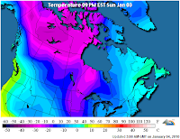
Much of the nation is already under a deep freeze. The first map from the Weather Channel and shows current wind chill values in the U.S., the second is from the Weather Underground and shows the cold Canadian air mass waiting in the wings.
January tends to be a pretty calm month for Denver. The National Weather Service's climatology page states it is Denver's coldest month, and fifth snowiest. The coldest temperature ever recorded in Denver of -29 degrees F occured during the month of January. Wind is often the biggest story of the month, providing us with those warm windy days so common during the early part of last year. Last January also made it in the top five for driest Januaries on record - let us hope 2010 starts a little wetter (and colder) than 2009!

Monday, December 21, 2009

Winter to Return

We will push 60 degrees again today as a warm, dry southerly wind gets pushed into the state ahead of the next cold front due in Tuesday night. A lot of uncertainty remains surrounding the exact track of this storm. At this point it looks like it will remain well south of the area bringing us just light snow over a prolonged period. The NWS is forecasting 3-6 inches with this current path, but suggests the storm is still far enough out that this could change quite a bit in the next 24 hours. For now the only advisories for the plains are well east of Denver where it looks like even with a southerly track the storm will be a bit stronger. The other story will be the cold. By Thursday temperatures will be some 40 degrees cooler than today.

According to this article by the NWS, the chance of there being at least an inch of snow on the ground for Christmas is about 36% over the last 107 years in Denver. The chance of measurable snowfall on Christmas day is about 13%.... Looks like this year we may at least have the former of the two!